RABAUL, Rabalanakaia Crater Centre, with an Older Crater behind, [ Palangiagia ], ENBP, by John B Dikaung, on 9-03-2012

RALUANA United Church along the Kokopo / Rabaul Road at Raluana, Photo by Gideon Kakabin, in ENBP, PNG, on 15-08-2012

Active Tavurvur Volcano with Mount Kombiu beside on left, across Blanche Bay from Raburua in Karavia Bay, RABAUL, ENBP, PNG, Photo by John B. Dikaung, on 24-11-2012

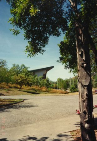
Only House left on Namanula Hill in RABAUL, ENBP, PNG, Photo by John B. Dikaung, on 20-07-2011

Round Bush Haus near Old RABAUL Airstrip side before Causeway across to MATUPIT Island, With Tavurvur Volcano behind in background in ENBP, By John Lau, on 18-08-2011

Sulphur Vents around inside of Rim of active Tavurvur Volcano Crater, with side of the Mother Peak on left, in RABAUL, in ENBP, PNG, Photo by John B. Dikaung, on 5-03-2011

TAVURVUR VOLCANO Crater from BLANCHE BAY Near RABAUL, in ENBP, By John Lau, on 30-07-2011

Early SunRise over RABAUL Volcanos from MALAGUNA Area across SIMPSON Harbour in ENBP, By John Lae, on 23-02-2012

Rabaul 1984

RVO, Rabaul Volcanco Observatory Monitoring Equiptment in Matupit Harbour near Matupit Island, in RABAUL, ENBP, PNG, Photo by John B. Dikaung, on 24-11-2012

Tavurvur Volcano Crater viewed from side of Mount Kombiu [ The Mother Peak,] RABAUL, ENBP, PNG, Photo by John B. Dikaung, on 2-01-2013

SDA Church on MATUPIT Island in RABAUL, ENBP, PNG, Photo by John B. Dikaung, on 20-08-2010, position not correct, ?

View on top of Namanula Hill in RABAUL, ENBP, PNG, Photo by John B. Dikaung, on 21-07-2011

Looking out of a WW11 Jap Tunnel at the Japanese Submarine Base near Tavui along the North Coast Road of RABAU, pass Nonga area, in ENBP, PNG, Photo by Richard Pratten, in July 2008

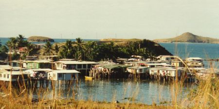
Matupit island

Flying above Vulcan Crater at bottom rightside, Looking into Simpson Harbour with the 2 Beehives Islands in centre, With Matupit Island in front of Active Tavurvur Volcano with Matupit Harbour between, with the tall Mother Peak in centre, Note Rabaul Town has Gone from the 1994 Erruption, in ENBP, PNG, Photo by Edward E.Piniau, on 8-05-2008

View from above Simpson Harbour, looking towards RABAUL Whalfs area, with side of the North Daughter Volcano Peak at right, also Watom Island behind in background, in ENBP, PNG, Photo by John B. Dikaung, on 04-05-2010

View from Ah Chee Avenue, RABAUL, of Rabalanakaia Crater, in ENBP, PNG, photo by John Lau, on 24-09-2012

Dawn over RABAUL Town, taken from on top of Mount Kabiu, better known as The Mother Peak, Looking over Rabalanakaia Crater just below on left, and into the Simpson Harbour, with Malaguna area on right, Talili Bay & Liguan Bay can be seen at Centre right in the Pacific Ocean, with Ataliklikun Bay at top left, in ENBP, PNG, Photo by De Las Dawn, on 18-11-2012

RABAUL Cemetary, after being dug out from the 1994 Eruption, most memorials were completely covered in Volcanic Ash for several years, behind the Old Rabaul Bung Market, ENBP, PNG, Photo by John B. Dikaung, on 19-07-2011

Looking up Bay Road from 2nd 22nd Street towards the North Daughter Volcano peak, RABAUL, ENBP, PNG, Photo by John B. Dikaung, on 21-07-2011

RVO, Rabaul Volcanologist Equiptment on side of Rabalanakaia Crater in RABAUL, with VULCAN Volcano viewed across Simpson Harbour, in ENBP, PNG, Photo by John B. Dikaung, on 20-09-2004

View along Kombiu Avenue in old RABAUL Town area, ENBP, PNG, Photo by John B. Dikaung, on 20-07-2011

Coconut Palms and Village Garden area on MATUPIT Island, in RABAUL, ENBP, PNG, Photo by Jane Esman, on 1-09-2012

RABAUL VOLCANO's viewed from Blue Lagoon, along the Rabaul Kokopo Road, in ENBP, PNG, photo by Gideon Kakabin, on 2012, photo enhanced

View of Watom Island at Sunset, from along the North Coast Road, near RABAUL, ENBP, PNG, photo by Fenelle Sam, on 28-09-2012

The Mother Peak [ Mount Kombiu,] on leftside of Rabalanakaia Crater, looking up from Grove or Norfolk Street in RABAUL, ENBP, PNG, Photo by John B. Dikaung, on 20-07-2011

The MOTHER PEAK Volcano, RABAUL, Close view from Saint George Channel, in ENBP, PNG, Photo by John Lau, on 15-06-2012

Early sunrise view from RALUANA Point area, in Blanche Bay, looking across to Talvat or Praed Point on tip of the South Daughter Peak, [ Mt Turanguna ] on right, with the tall Mother Peak [ Mt Kombiu ] in centre, while active Tavurvur throwing up Steam and Ash Cloud on left, in RABAUL, in ENBP, PNG, photo by Gideon Kakabin, on 20th Sept 2012

View from top of the Mother Peak, Mount Kombiu, looking towards the South Daughter Peak on left, with simmering Tavurvur Volcano in centre in Matupit Harbour, Across Blanche Bay is Karavia Bay and the Baining Mountains on the GAZELLE Peninsula, RABAUL, in ENBP, PNG, photo by Janette Waraker, in Oct 2012

Tavurvur Volcano Spewing out Volumes of Ash over RABAUL area and Blanche Bay on12th March 2013, in ENBP, PNG, Photo by Fenella Sam, on 12-03-2013

view from Raburua area near Davaon in Karavia Bay, looking towards the RABAUL Volcano's in ENBP, PNG, Photo by Tania Basious, on 3-11-2012

Active Tavurvur Volcano viewed from Malmaluan Hill area in ENBP, PNG, Photo by Gidean Kakabin, on 21-01-2013

Vulcan October 1994

Gateway Entrance to Governors Residence on Namanula Hill in German and Australian Colonial Administration time, With '' Mount Kombui,'' The Mother Peak in centre and Rabalanakala Crater on rightside, in RABAUL, in ENBP, PNG, Photo by Gideon Kakabin, on 8-02-2013

Yawning Simmering TAVURVUR Volcano in Blanche Bay, with Raluana Point across, viewed from the top of the Mother Volcano Peak, in RABAUL in ENBP, PNG, photo by Janette Waraker, in Oct 2012

CPL, Coconut Processing Ltd, viewed from in Simpson Harbour area, in ENBP PNG, Photo by John Lau, on 16-02-2013

Old RABAUL Airport Runway end viewed from in Simpson Harbour, with active Tarvurvur Volcano behind, and the South Daughter Peak in background, in ENBP, PNG, Photo by John Lau, on 16-02-2013

RABAUL Hot Springs in Matupit Harbour near end of Old Rabaul Airport Runway, with South Daughter behind on left, & active Tavurvur Crater in centre behind, in ENBP, PNG, Photo by John Lau, on 16-01-2013

Malmaluan Hill lookout view over Simpson Harbor and RABAUL Volcano's with Vulcan Crater at centre front, and active Tavurvur behind on right, in ENBP, PNG, Photo by Gidean Kakabin, on 21-01-2013

View towards Sulphur Point area of active Tavurvur Volcano with The green Mother Peak behind , in RABAUL, in ENBP, PNG, Photo by John Lau, on 15-01-2013

volcanoes

Tourist Ship berthed at the RABAUL Whalf in Simpson Harbour, in ENBP, PNG, Photo by Jane Esman, on 14-10-2012

RABAUL Volcano's viewed from in Simpson Harbour, with Rabalanakala Crater in centre, and the Mother Peak behind, with South Daughter peak behind in centre & Tavurvur Volcano on right, in ENBP, PNG, Photo by John Lau, on 16-2-2013

View from along North Coast Road from Tunnel Hill in RABAUL, in ENBP, PNG, Photo by Tatyjana Micah, Teejay pics, in Dec 2012

Malmuluan Towers viewed from Koonex area in ENBP in PNG, Photo by Esau Mellie on 24-05-2013
Photos provided by Panoramio. Photos are under the copyright of their owners.